By Sean Fagan
.
In the following photo-journal - I've briefly explored two favourite outdoor subjects of mine - prehistoric archaeology & old place names.
I hope you enjoy these aspects of the outdoors as much as I do.
All that is often required to find these features is a good topographical map and curiosity.
If you haven't already - I strongly urge you to put on your hiking boots and go walking.
Find an ancient ruin or intriguing place-name - and sit a while.
.
Let your imagination roam...
.
The following photos are from another article on this website...3 Great Uses of Maps.
.
You might be wondering what does prehistoric archaeology and old place-names got to do with bushcraft?
As I've stated before - bushcraft is far more than the technical mastery of traditional and modern outdoor skills (and knowledge).
It's also about connecting to the essence of a landscape.
.
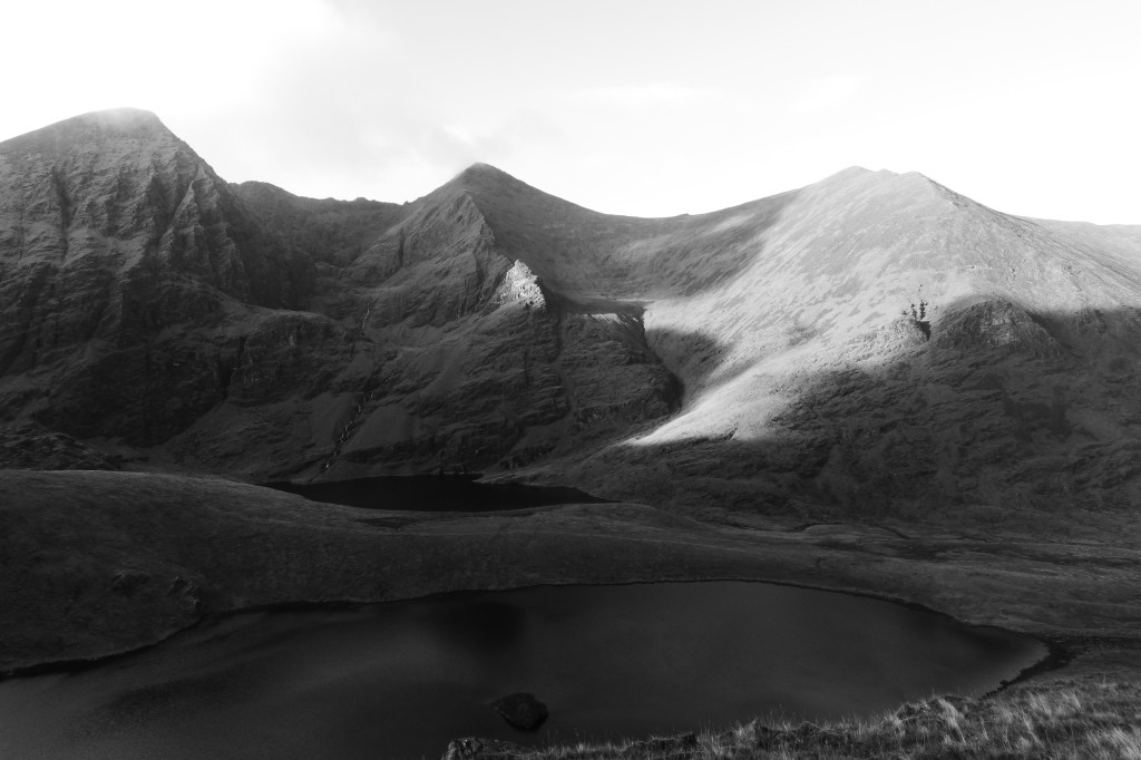
THE PERSISTENCE OF OLD NAMES: In this photo alone, of the western portion of the Hag's Glen (Southwest Ireland) there are at least 15-20 Irish places names for many of the topographical features. Some of the place names date from the 18th century, some from medieval times. There is a good chance that some date from the first farmers, the Neolithic people or even further back in history when Ireland was populated by small, nomadic groups of hunters and gatherers. The simple answer is we don’t know when a lot of the place names were created and if there was multiple place names for a given area associated with successive waves of human colonisation. For example, the lake in the foreground is called Hag's Lake (Lough Callee). Why? We don't really know, but it certainly poses some interesting questions. However some place-name are less ambivalent. The mountain to the far left is Carrauntoohil. Notice in photo the huge ledge about half-way down its right flank (which spans between Carranutoohil and the adjoining mountain - Beenkeragh, to the right). This massive ledge is called Nead an Iolair - the Eagles Nest. Not hard to see why. Historically though, golden and white tail eagles did inhabit this remote glen. An example of a place-name accurately recording historical fact? One of the great things about place-names is that they can paint a picture in the mind of what a landscape looked and felt like. They can tell you what wild animals once roamed there, what trees formed the old primeval woods of the past. They also allow you to tap into the collective imagination of the people from there - allowing a glimpse into their beliefs, their world views. Place-names can often be precious links into forgotten cultures where the physical evidence of these cultures (e.g shelters) has disappeared or greatly deteriorated. At the risk of coming across as whimsical - old place-names can also resonate with us, striking a chord of familiarity. After all, they were often created by our own ancestors (Photo: Sean Fagan).
.
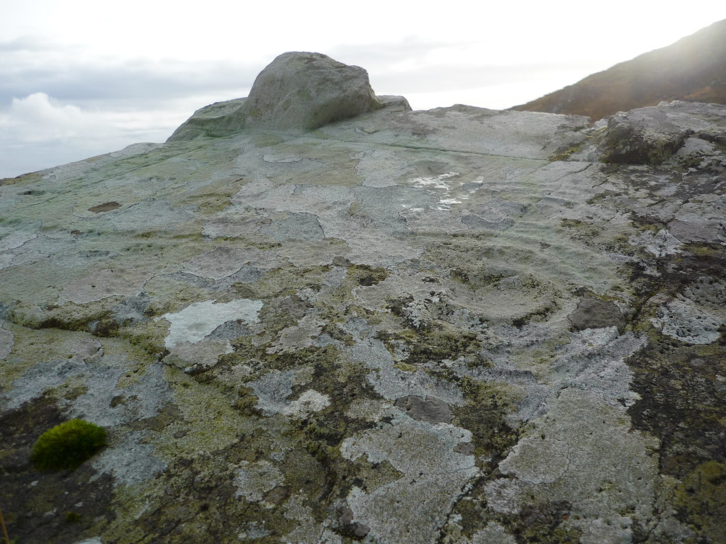
AN ANCIENT CALENDAR? In southwest Ireland, Bronze Age rock art are mostly multiple circular engravings made on prominent rocks. Star maps? Celestial calendars for significant annual activities such as sowing seeds or hunting certain game throughout the year? We simply don’t know. What they strongly suggest is an ancient people that were, most likely, profoundly connected and attuned to their surroundings- but this is hardly surprising. We know the Bronze age people were mostly farmers and were, like most farmers, attuned to their environment. The question is - how much? What stirred their hearts and minds about the surrounding lands...land they tried to tame with somewhat precarious methods of primitive farming? (Photo: Sean Fagan).
.
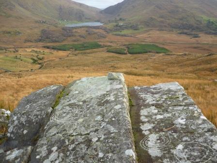
WHY WAS EAST SO IMPORTANT? Interestingly, a lot of the famous rock art of Ballagh Beama pass, Southwest Ireland, are aligned with East (90 degrees). In the distance, the gap between the mountains (just above the lake in photo) is almost exactly due east, exactly where the sun arises for a significant portion of the year. Coincidence or intended design? What were they trying to do? How did they perceive the sun? (Photo: Sean Fagan).
.
.
"but here in the wilderness the landscape carried me back into the midst of life infinitely remote" ~ John Muir
.
.
Related articles on this website:

Recent Comments